GYROSCAN – the revolution of global agriculture

GYROSCAN is a project that will significantly accelerate the development and revolutionize precision farming. The developed decision support system in agrotechnical treatments sets new trends and solutions for modern farms.
Using the remote sensing, comprehensive DSS (Decision Support System) method, we can research and develop new areas of agriculture, define the needs of irrigation, fertilization and pest control in the context of the requirements and goals of precision agriculture. The remote sensing method is also used to: assess the extent of the occurrence of pests and diseases in forests and the degradation of meadows (the degree of vegetation biodiversity in a given place).
Why are gyroplanes important in precision agriculture?
The most important advantages of gyroplanes in precision agriculture, in addition to safety and economy of use, are:
- Low sensitivity to gusts of wind and side winds
- Pilot – does not need to have special qualifications (a qualification certificate + experience is enough)
- Simple rules of service and operation (one mechanic with a qualification certificate)
- Admission to the provision of services without the requirement of service certification (possibility of using specialized equipment)
- Possibility to land on adventurous areas, without aviation infrastructure (easier adaptation of accessories to commercial treatments)
Decision support in precision agriculture.
Optimization of fertilization, irrigation and plant protection treatments, as well as farm management support, including:
- Forecasting yields for the field and spatial variability of yielding within the field.
- Identification of plant growth anomalies within the field (possibly biotic threats).
- Optimization of soil / plant sampling (N (PK) fertility study) within the field.
- Modeling of the spatial variability of N (PK) within the field, ultimately development of application maps for NPK fertilizers.
- Modeling of spatial variability of water content in plants.
Based on the relationship between the NDRE remote sensing indicator and the LAI indicator, and the size of the biomass, you can create maps of parameter distribution in the fields:
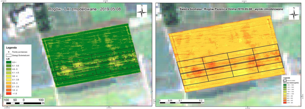 Map and LAI and biomass for the winter wheat field (Rogów) – the stage of shooting at the blade
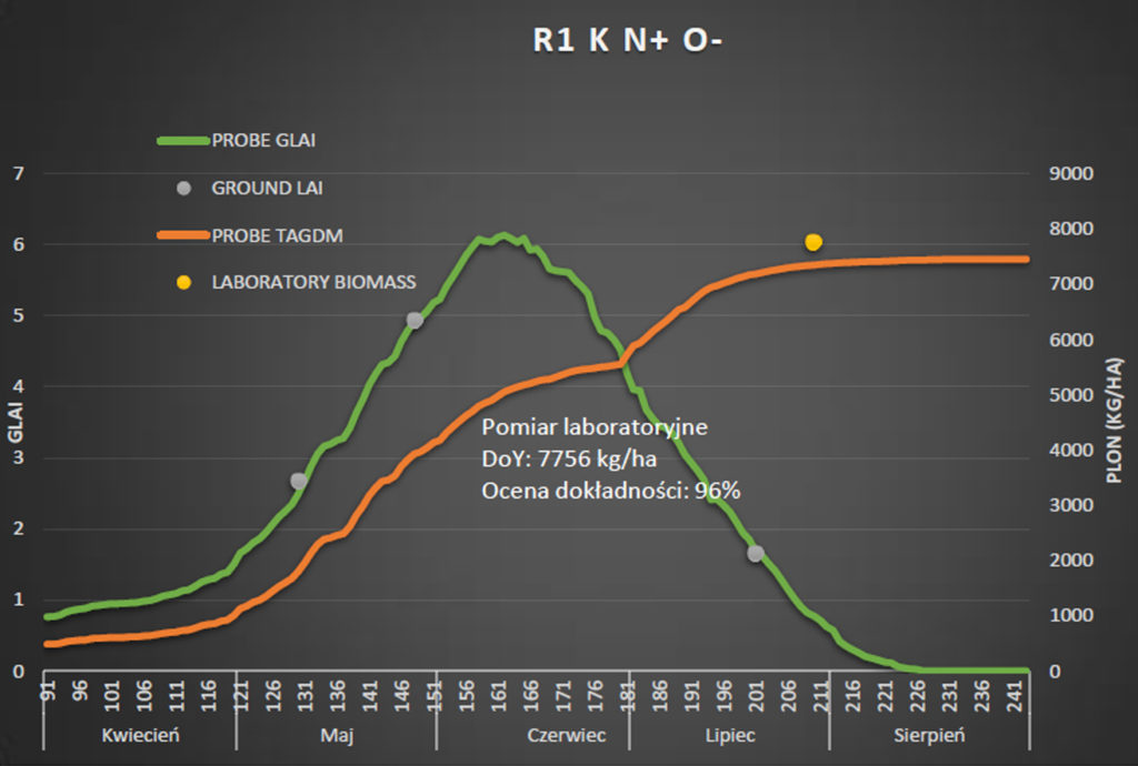
Modeling results for an example wheat field:
- Green plot: LAI simulation from the PROBE model
- Orange diagram: Biomass simulation
- Yellow dot: Actual biomass obtained in the field
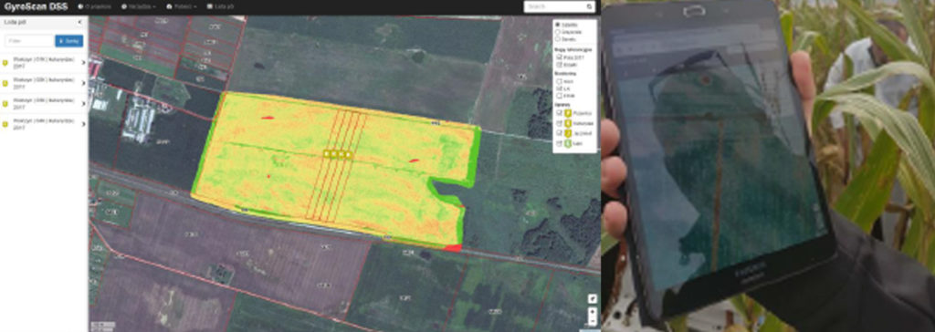
DSS (Decision Support System) is a technical and organizational solution that allows you to obtain data, process them, model and analyze parameters describing the condition of vegetation, and develop information products and services. The results of the analyzes and modeling are made available to the user using the web application.
The application user has access to information describing his farm in the field of monitored fields. As a result of plant growth and plant condition modeling, data are generated that supplement the information for the field:
- Tips for hydration treatments,
- Yield (forecast)
- Data for the field average yield (crops -historically),
- Technological card
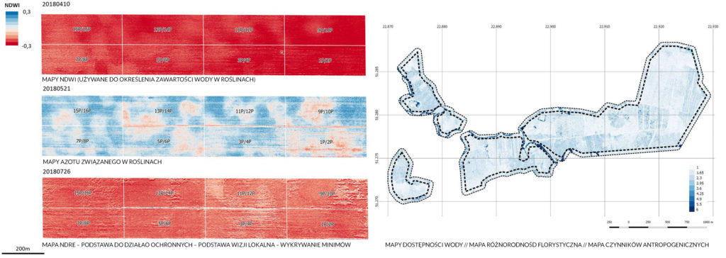
Hyperspectral scans, transformed into orthoimages, are used to develop a number of spectral indicators and to classify vegetation.
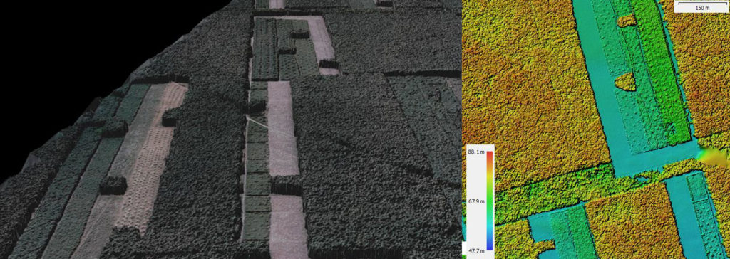
Thanks to an additional RGB camera, it is possible to create a numerical model of land cover:
The spectral registration module mounted on the gyroplane precisely reflects the condition of the soil / plant surface and indicates the areas where there is a need for specific agrotechnical treatments.
The multi-temporal analysis of the spatial variability of hyperspectral indicators allows for the verification of cultivation technology and determination of the condition of plants depending on the type of agrotechnical treatments and growth conditions.


